The Wheatbelt is the great farming region that curves around Perth to the north, east and south-east, covering a huge area of cleared land, granite outcrops, salt lakes and remnant bushland. It produces much of Western Australia's grain, and its small towns grew up along railways and roads that served the farms. For travellers, the Wheatbelt offers quiet roads, big skies, unusual rock formations and some of the best spring wildflower displays in the state.
This guide covers Wave Rock and Hyden, other granite outcrops, New Norcia, wildflower routes, practical driving advice and suggested itineraries.
~340 km
Perth to Wave Rock
About four hours by road
~15 m
Height of Wave Rock
About 110 m long
Jul–Oct
Wildflower season
Peak timing varies by year
Wave Rock and Hyden
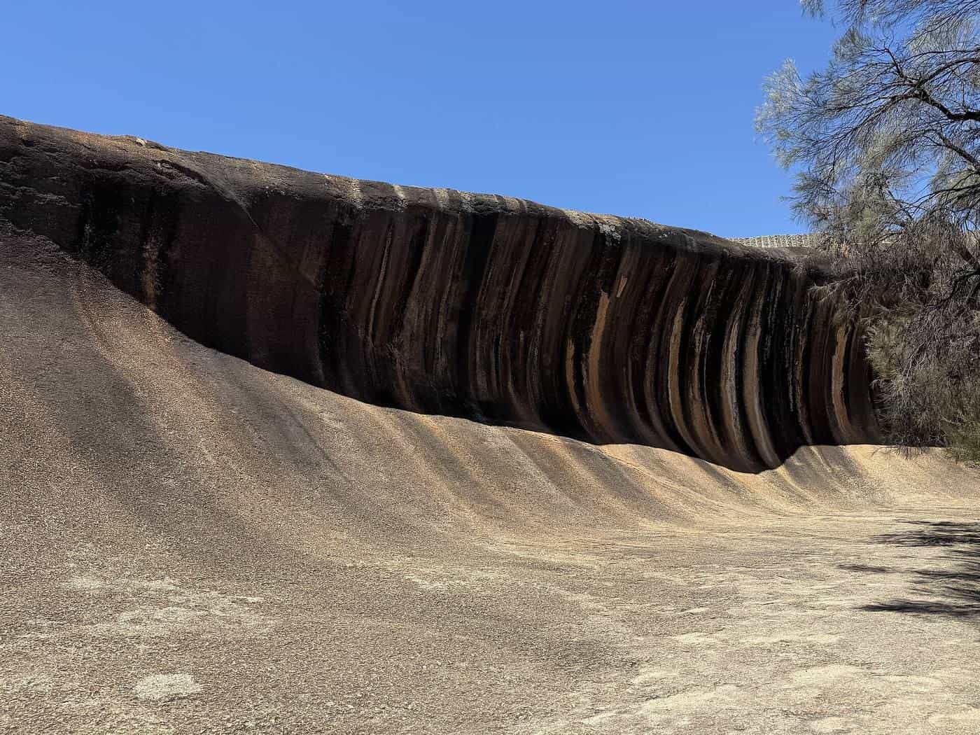
Wave Rock is the Wheatbelt's most famous landmark: a granite cliff about 15 m high and about 110 m long that curves like a breaking wave. It forms part of the northern face of Hyden Rock, a larger granite outcrop near the small town of Hyden. Vertical streaks of colour on the rock come from minerals and algae washed down by rain.
Geologists believe the shape formed underground over an immensely long time, as moisture in the soil weathered the base of the granite. When the surrounding soil eroded away, the undercut face was exposed.
Walking trails lead around and over Hyden Rock, with views across farmland and salt lakes. A low wall on top of the rock was built to direct rainwater into a dam, a reminder of how precious water has always been in this dry country.
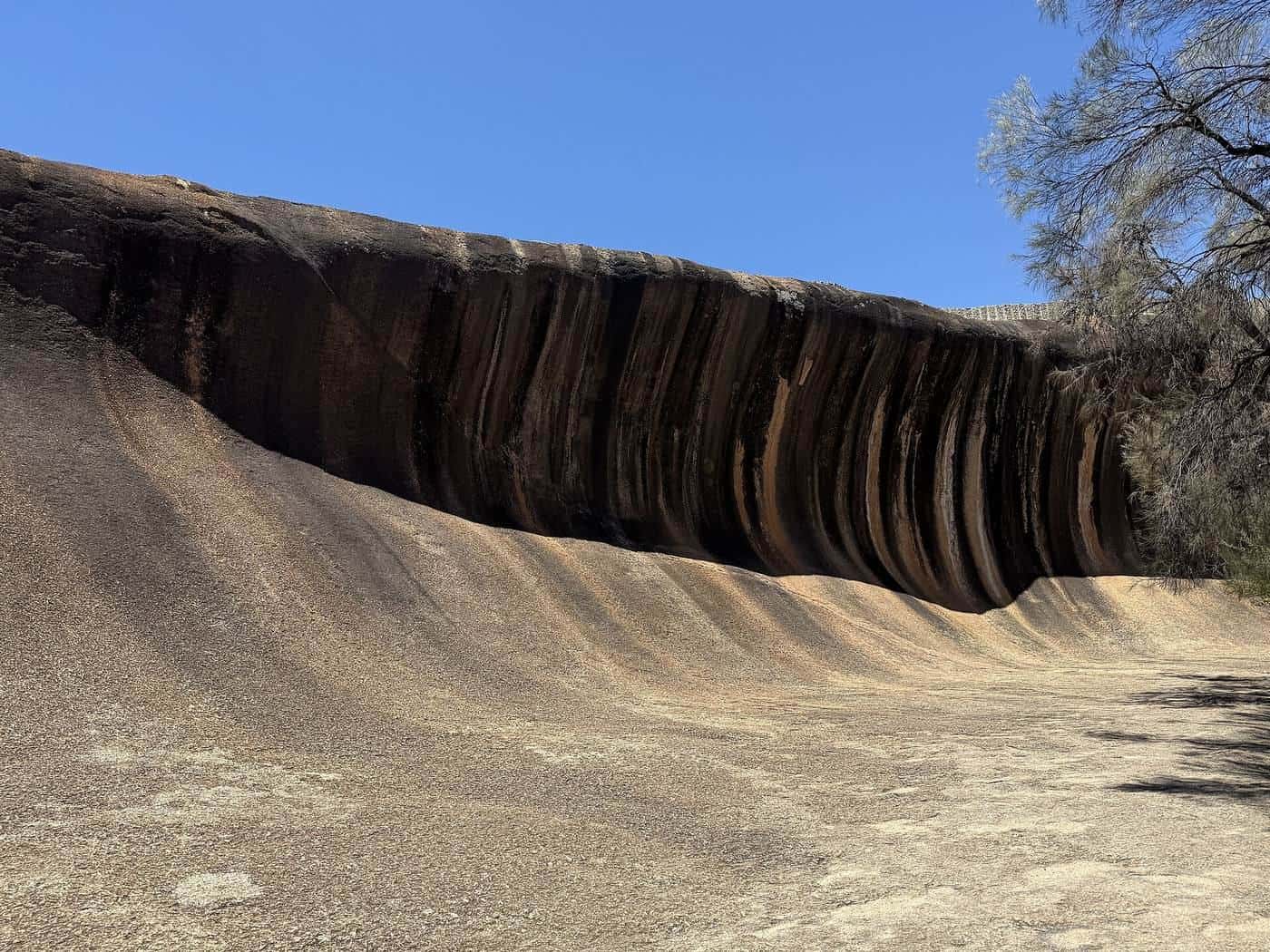
Near Wave Rock
- Hippo's Yawn is a granite formation a short walk from Wave Rock, shaped like an open mouth.
- Mulka's Cave, north of Hyden, contains a large number of Aboriginal hand stencils and paintings. It's a significant cultural site; look, don't touch.
- Salt lakes around Hyden turn pink, white or silver depending on the season and light.
Entry fees may apply to some sites near Wave Rock. Check before you visit.
Other granite outcrops
Granite outcrops dot the Wheatbelt and were important water sources for Aboriginal people and early settlers. Many have walking trails and picnic areas. Kokerbin Rock near Kwolyin, Elachbutting Rock with its wave formation and cave, and the rocks around Merredin and Narembeen are worth visiting on a slower trip. In spring, the shallow soils around outcrops support orchids and other wildflowers.
New Norcia
About 130 km north of Perth on the Great Northern Highway, New Norcia is a monastic town founded by Spanish Benedictine monks in 1846. It's still home to a small community of monks. The town's buildings combine Spanish, Italian and other European styles. Visitors can explore the museum and art gallery, join a town tour and buy produce from the monastery bakery. New Norcia is an easy day trip from Perth or a stop on the way north.
Wildflowers
Western Australia has one of the richest floras in the world, and the Wheatbelt's remnant bushland, road verges and nature reserves come alive with colour from late winter into spring. Look for everlastings, orchids, wattles, kangaroo paws and banksias. Peak displays move from north to south as the season progresses and depend on winter rains.
Wildflowers are protected. Stay on tracks, don't pick flowers, and park well off the road when stopping to look.
Driving in the Wheatbelt
Roads are mostly sealed, straight and quiet, but they bring their own risks.
- Distances. Towns can be 50 km or more apart. Fill up when you can, and carry water and snacks.
- Fatigue. Long, straight roads cause fatigue. Take a break at least every two hours.
- Wildlife. Kangaroos and emus are common, especially at dawn and dusk. Avoid driving at those times where possible.
- Trucks and farm machinery. Grain trucks and road trains are common, especially at harvest. Overtake only when you can see well ahead. Wide farm machinery may use roads.
- Unsealed roads. Gravel roads can be slippery and dusty. Slow down and drive to the conditions.
- Mobile coverage. Coverage is patchy between towns.
Check Main Roads WA for road conditions and closures.
Small towns
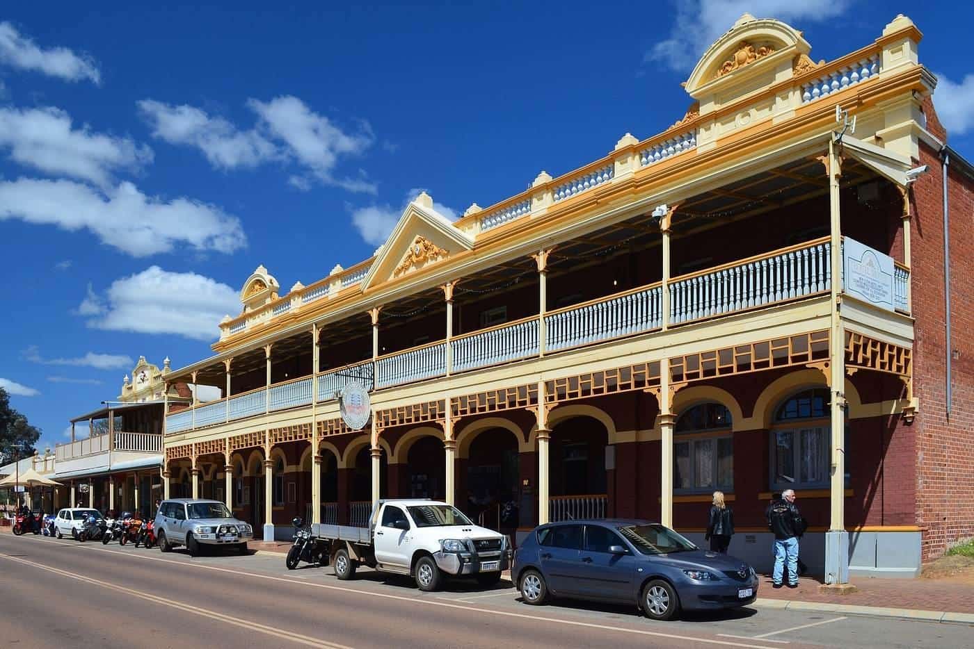
Wheatbelt towns are often small, with a pub, a store, a fuel station and a few historic buildings. Many have grain silos, and some have painted silo art. Local museums tell the story of the railways, farming and the communities that built them. Opening hours can be limited, particularly on weekends, so check ahead.
When to go
- Late winter and spring (July to October) is the most popular time, with wildflowers, green crops and mild days.
- Autumn (March to May) is often mild and settled.
- Summer (December to February) is very hot and dry, with bushfire risk. Check Emergency WA and total fire ban information.
- Winter (June to August) brings cool days and cold nights.
Wheatbelt road trip checklist
0 of 8 done
Ticks are saved in this browser only.
Suggested itineraries
Two days. Drive to Hyden via Corrigin or Kondinin, see Wave Rock, Hippo's Yawn and Mulka's Cave, and return via a different route.
Three to four days. Add more granite outcrops, small towns and wildflower reserves, or link the Wheatbelt with the Avon Valley.
A spring loop. Combine New Norcia, the northern Wheatbelt wildflower routes and the Coral Coast for a longer trip north of Perth.
Common mistakes
- Trying to do Wave Rock as a day trip from Perth. It's possible, but it means eight hours of driving.
- Running low on fuel between towns.
- Picking wildflowers. They're protected.
- Driving at dusk, when wildlife collisions are most likely.
Accommodation
Hyden and many Wheatbelt towns have motels, caravan parks, hotels and bed and breakfasts. Options are limited, so book ahead in spring, school holidays and long weekends. Some granite outcrops and nature reserves have basic campsites; check rules before camping.
Travelling with children
Wave Rock is a big hit with children, and short walks over Hyden Rock are manageable for most ages. Pack snacks, water and entertainment for the long drives, and plan regular stops at towns along the way.
Key points
Wave Rock is about four hours east of Perth and best enjoyed with an overnight stay. Visit in late winter or spring for wildflowers, fill up fuel often, avoid driving at dawn and dusk, and allow time to explore granite outcrops, small towns and New Norcia.
Frequently asked questions
How far is Wave Rock from Perth?
Wave Rock, near the town of Hyden, is roughly 340 km east of Perth by road, about four hours of driving each way. Most people stay at least one night rather than doing it as a day trip.
How big is Wave Rock?
Wave Rock is a curved granite cliff about 15 m high and about 110 m long, forming part of the northern side of a larger granite outcrop called Hyden Rock.
How was Wave Rock formed?
Geologists believe the wave shape formed over a very long time as the granite at the base of the outcrop was weathered beneath the soil surface, and then exposed as the surrounding ground was eroded away.
When is the best time to visit the Wheatbelt?
Late winter and spring, roughly July to October, is the most popular time, with wildflowers, green crops and mild weather. Summer is very hot and dry.
What is New Norcia?
New Norcia, about 130 km north of Perth, is a Benedictine monastic town founded in 1846. It's known for its Spanish-influenced buildings, museum and art gallery, and is still home to a community of monks.
Is fuel easy to find in the Wheatbelt?
Most towns have fuel, but distances between towns can be long and some fuel stations have limited hours. Fill up when you can and carry water.
Sources and further reading
Facts on this page were checked against these primary and official sources. Conditions change — confirm before you travel or buy.
- Wave Rock — Wikipedia
- Wildflowers in WA — Parks and Wildlife Service WA
- New Norcia — Wikipedia
- Travel map and road conditions — Main Roads WA